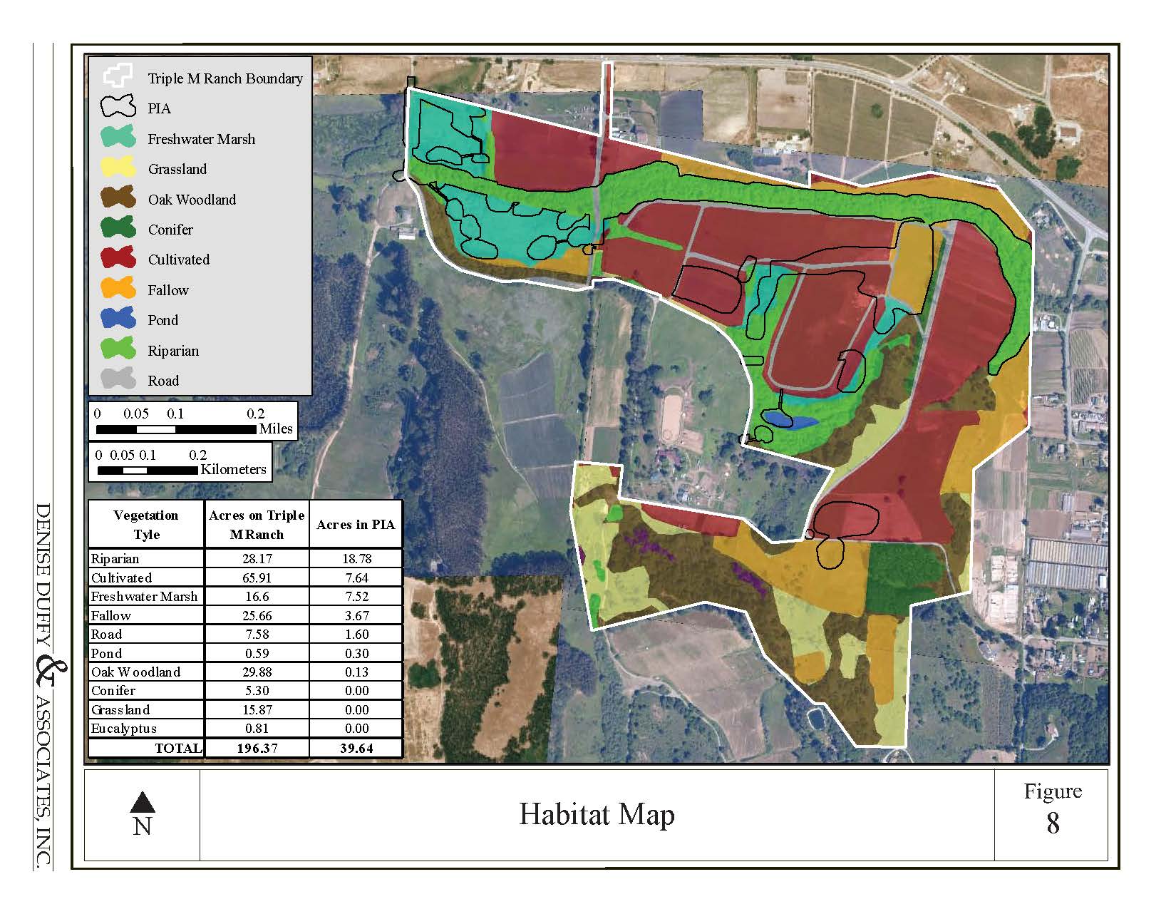
Geographic Information Systems
DD&A incorporates GIS into resource planning to evaluate complex analytical and spatial resources with accuracy and clarity using the latest GIS technology.
GPS Data Collection
GIS Data Creation, Management, and Manipulation
GIS Based Professional Quality Cartographic Products
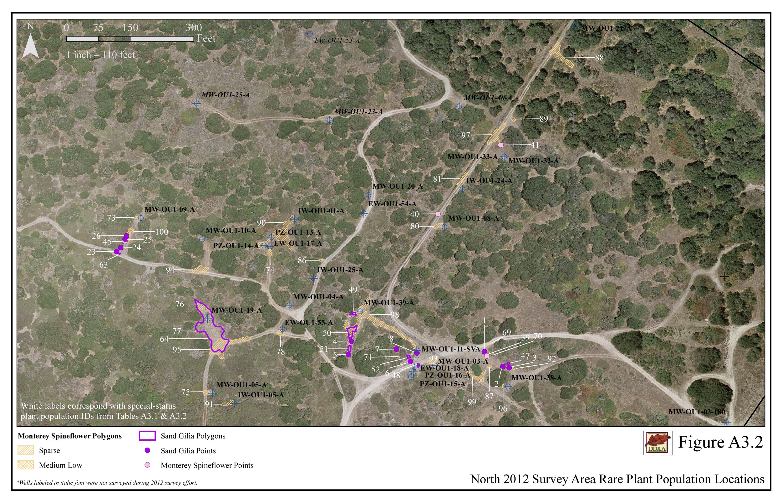
Fort Ord Natural Reserve Rare Plant Surveys